Virtual Reality
Lion of Amphipolis
South Wall
Wooden
Bridge
North
Wall
Tomb of
Brasidas
Tower of
Marmariou
Archaeological
Musieum
Macedonian
Tomb
Strymonas
River
Nea
Amfipoli
Kasta
Tomb
Dam
Port
Environmental
Center
Observatory
Buffaloes
Bird Colony
Flamingo Migration
Traditional Fishing
Lithotopos
Strymonas River
Plain of Serres
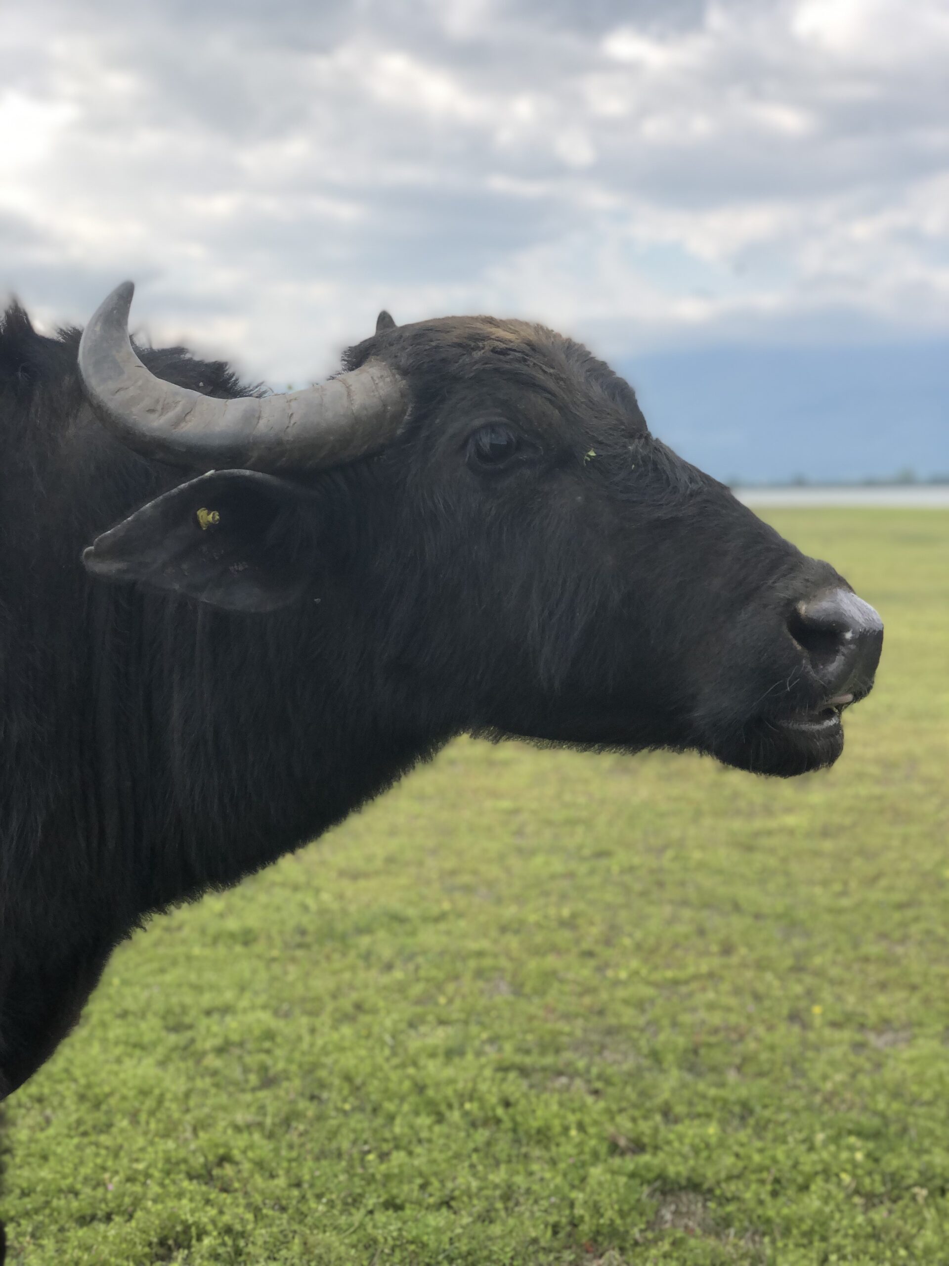
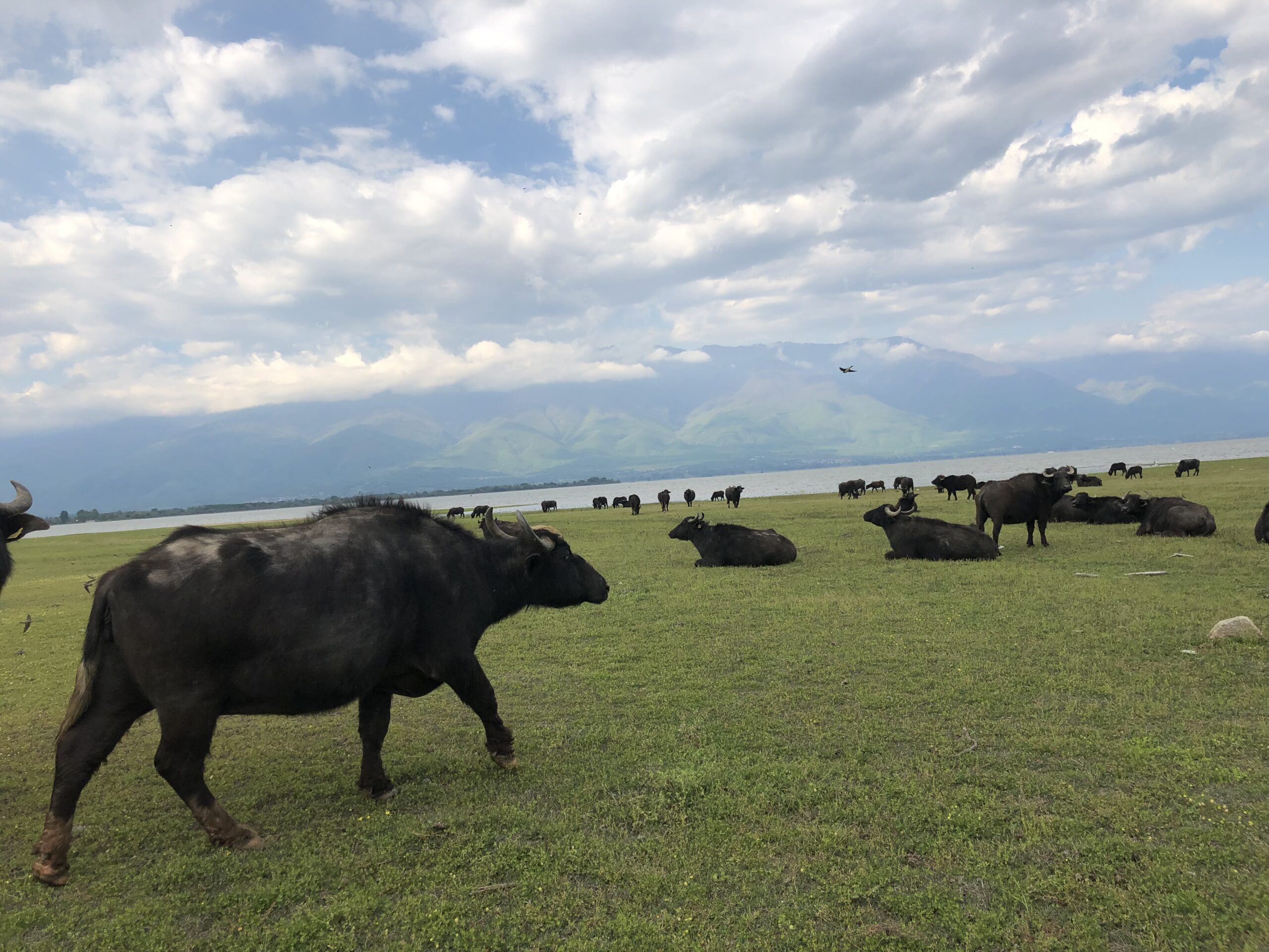 Buffaloes
Bird Colony
Flamingo Migration
Traditional Fishing
Lithotopos is a lowland village of the regional unit of Serres at an altitude of 45 meters, which is located on the southern shores of Lake Kerkini, to the north of the plain of Serres. According to the Kallikratis plan, it is the Local Community of Lithotopou which belongs to the Municipal Unit of Heraklion of the Municipality of Heraklion and according to the 2011 census it has a population of 692 inhabitants
The Strymonas (Bulgarian: Струма, Struma) is a river in southeastern Europe with a total length of 392 kilometers, of which 274 are in Bulgarian territory and 118 in Greek. In Greek territory, the river flows exclusively in the territory of the Regional Unit of Serres and together with the Aggitis, which is its main Greek tributary, belong to the hydrographic basin of eastern Macedonia.
Its watershed covers an area of 17,300 sq.km., of which 11,035 sq.km. belong to Bulgaria and the 6,295 sq. km. in Greece, and its average annual runoff is estimated at 3,440 x 106 cubic meters. The rocks of its watershed are mainly metamorphic composed of gneisses, schists and marbles. There are also igneous rocks and ore-bearing sedimentary rocks. In some places of its riverbed there are concentrations of alluvial gold.
The river is rich in transported materials that continuously pour into the plain of Serres and Lake Kerkini. Specifically, it is estimated that at least four million (4,000,000) cubic meters of transportable materials are transported annually, in an average annual runoff of 3.4 billion cubic meters of water. Its width exceeds 250 meters, while its depth reaches 3 meters.
The third largest plain of the country is that of Serres, after the plains of Larissa and Thessaloniki. It stretches from the Bulgarian border and the Beles mountain range to the sea and the Strymonian Gulf. The river Strymonas is the feeder, especially after 1932, when the dam that will create the artificial lake Kerkini and the canals with water, which will transform many of the fields from dry land to irrigated land. Rice, corn, wheat and tobacco were the main products of the prefecture from earlier times but also especially from the 20s and 30s, when refugees came to the area from greater Turkey, the Pontus, eastern Rumilia (southern Bulgaria) and the south of Russia. Then all the lands were distributed to the refugees and they began to be cultivated systematically. Small lot for each, small lands and small production, almost enough for families to be self-sufficient.
It goes without saying that today, in 2016, a lot has changed in the plain of Serres. The Carolina rice of Serres is still famous, as the soil, the lack of strong winds and the waters of the area, give it a special taste and make it compete with Italian rice for risotto. Maize and wheat, peanuts, almonds, potatoes in Ano Vrontou, beans in Oreni continue to be cultivated and next to them new crops, the so-called dynamic ones: pomegranates and aronias, durum wheat and aromatic plants.
Observatory
Start & Finish
Line
Main
Entrance
Central Pit Stop
Garage
Final Turn
"S" Turn
Cafe
Back Pit Stop
Spectator
Seats
Kart Circuit
Inner Parking
Outer Parking
Chalet
Parking
Start of the Track
Shelter
Access Road
Peak
Lift
Moderate Track
Visit OPAKPA where a suitably configured Virtual Reality (VR) place awaits you to explore the points of interest of Serres. Through virtual reality, you can enjoy a live experience of digital touring that provides the sense of a real site.
